More than 90% of the world breathes polluted air. Yet, many cities lack ground monitoring data needed to track air pollutants that impact public health.
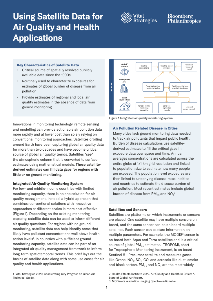
For countries with limited monitoring capacity, there is no one solution for air quality management. Instead, a hybrid approach that combines conventional solutions with innovative approaches at different scales is more cost effective. One approach includes the use of satellites and sensors. Satellites orbiting around Earth have been capturing global air quality data for more than two decades and have become critical source of global air quality trends. Satellites “see” the atmospheric column that is converted to surface estimates using mathematical models. These satellite derived estimates can fill data gaps and provide estimates of regional and local air quality in the absence of data from ground monitoring
This brief provides an overview on using satellite data for air quality and health applications, resources and trainings for cities to start integrating satellite data into their air quality management plans and national and access to regional datasets.
Recent Abstracts
Analysing India’s Unique Subnational WHO FCTC Article 5.3 Policies and Their Implementation Across 17…
Strengthening the Tobacco Cessation Ecosystem
Activity Report 2025 – Brazil
More Data Better Health – Brazilian People’s Perceptions of Risk Factors for Cancer
Relatório de Atividades 2025 – Brasil
Mais Dados Mais Saúde – Percepções da população brasileira sobre fatores de risco…
What Primary Care Records Reveal About Cancer Signs and Symptoms
O que os prontuários da atenção primária revelam sobre sinais e sintomas de…
CRVS Performance Measurement and Monitoring Resource Kit
Model Kentucky Ordinance Establishing a County Opioid Abatement Advisory Council